


This Green Tech Skillnet Micro Credential is co-funded by the Government of Ireland and the European Union www.eufunds.ie.
Note: Grant funding comes from Skillnet Ireland through the Irish National Training fund, and, as a result, is ONLY available to residents of the Republic of Ireland who work as a sole trader, or for a private or semi-state commercial company registered in ROI. If you are not eligible for the discount, you will still have the option to enrol by paying the full course fee. Please read Eligibility Criteria.
Applications are closed now. Enquire now to be added to the waitlist for future iterations.
Live tutorial each Wednesday evening
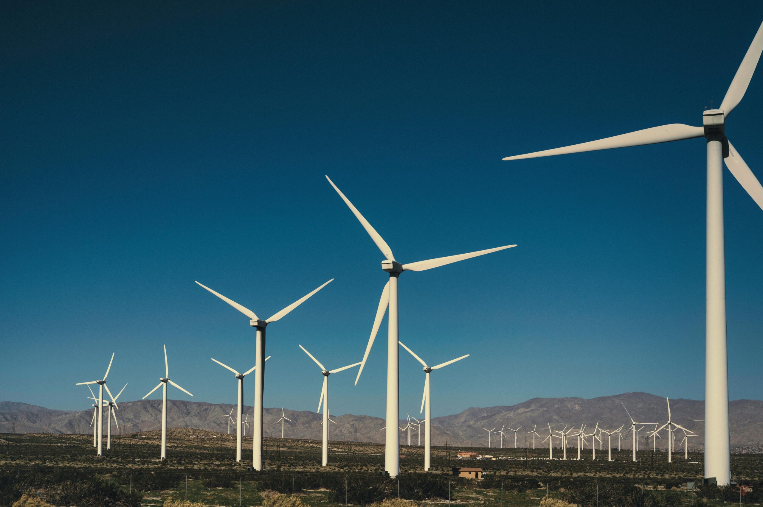
Focusing on the Wind Energy sector, this module provides a comprehensive introduction to Landscape and Visual Impact Assessment (LVIA). It equips students with the conceptual foundations, technical skills, and applied competencies required to evaluate the potential landscape and visual effects of development. Combining theory, fieldwork, digital spatial analysis, and professional reporting, the module supports learners in developing practical, ethical, and forward-looking LVIA capacities relevant to contemporary planning and environmental practice.
Delivered by leading academics/researchers in Geography and Sustainability from UL’s School of History & Geography and Associate Lecturers from Industry and the Wind Energy Sector
Module Structure and Key Themes
- Foundations of LVIA and its Role in EIA
- Introduction to EIA and wider environmental planning frameworks
- Definition of landscape vs visual impacts
- Role, purpose, and legal/ policy context of LVIA
- Relationship between LVIA, SEAs, and landscape planning
Linked Learning Outcome: LO1
- Guidelines, Standards, and Methodological Approaches
- Introduction to GLVIA (3rd edition) and international best practice
- Scoping processes, assessment frameworks, and professional responsibilities
- Digital tools: GIS, remote sensing, photogrammetry, digital terrain models
- Data sourcing, management, and metadata standards
Linked Learning Outcome: LO2
- Baseline Data Collection and Receptor Sensitivity
- Field survey techniques tailored to wind farm assessments, including landscape character appraisal, visual baseline studies, and structured photography capturing turbine visibility zones.
- Identifying landscape and visual receptors likely to be affected by wind turbine installations, such as residential viewpoints, heritage landscapes, transport corridors, and recreational areas.
- Assessing sensitivity and magnitude of change specific to wind energy infrastructure, considering turbine height, motion, layout, and cumulative effects.
- Integrating qualitative and quantitative data e.g., visual simulations, ZTV analysis, viewpoint evaluations) to support robust landscape and visual impact assessments for wind energy projects.
Linked Learning Outcome: LO3
- Assessing Impact Significance and Mitigation Planning
- Evaluating significance in accordance with GLVIA
- Landscape design principles for mitigation
- Nature-based solutions and green/blue infrastructure integration
- Cumulative assessment and alternative scenario evaluation
Linked Learning Outcome: LO4
- Reporting, Visualisation, and Professional Communication
- Structure and components of LVIA reports for wind energy assessments
- Use of visual tools: viewpoints, wireframes, photomontages
- Communicating technical information to stakeholders and the public
- Preparing professional written, verbal, and graphical outputs
Linked Learning Outcome: LO5
- Ethics, Innovation, and the Future of LVIA
- Ethical considerations: transparency, objectivity, and visual accuracy
- Climate change impacts, adaptive planning, and resilience
- AI, automation, and emerging digital environments (e.g., VR/AR for LVIA)
- Reflecting on evolving practice and professional responsibilities
Linked Learning Outcome: LO6
- Applied Group Work and Real-World Case Studies
- Team-based analysis of existing LVIAs or live development proposals
- Field-based and GIS-based collaborative exercises
- Integrating interdisciplinary perspectives (ecology, heritage, planning)
- Presenting group findings and developing landscape planning responses
Linked Learning Outcome: LO7
Module Skills and Graduate Attributes
Students completing this module will develop:
- Advanced spatial analysis and geodata management skills
- Field survey and visualisation competencies
- Professional report writing and stakeholder communication skills
- Collaborative problem-solving abilities
- Critical awareness of contemporary environmental challenges
- Understanding of the role of LVIA in sustainable landscape planning
LVIA delivery – timetable
| Date | Activity | Time |
| 16th February | Application Closing | Midnight |
| 24th February | Week 0 – Online Induction | 7-9.00pm |
| 3rd March | Week 1 – Online Tutorial | 7-9.00pm |
| 10th March | Week 2 – Online Tutorial | 7-9.00pm |
| 17th March | Week 3 – Online Tutorial | 7-9.00pm |
| 21st March | Lecture & Workshop @ University of Limerick | 10am – 4pm |
| 24thMarch | Week 4 – Online Tutorial | 7-9.00pm |
| 31st March | Week 5 – Online Tutorial | 7-9.00pm |
| 7th April | Week 6 – Online Tutorial | 7-9.00pm |
| 11th April | Site Visit – Location TBC | 10am – 4pm |
| 14th April | Week 7 – Online Presentations | 7-9.00pm |
| 20th April | Assignments – Online Submission Deadline | Midnight |
*Pre-recorded lecture videos and associated material are released on Fridays, before the start of the new week.
**Online Tutorials are Tuesdays from 7pm -9pm. Occasionally tutorials will host an industry partner.
*** Events at UL on 21st March and the site visit on 11th April, will both host and involve industry partners.
- Define and distinguish between landscape and visual impact assessment and explain their roles within Environmental Impact Assessment (EIA).
- Apply industry-standard guidelines (e.g. GLVIA) and spatial tools (e.g. GIS, Remote Sensing) to conduct LVIA, particularly for the Wind Energy Sector.
- Identify and evaluate landscape and visual receptors and assess their sensitivity using appropriate baseline data collection methods particularly for the Wind Energy Sector.
- Assess the significance of landscape and visual impacts and develop context-sensitive mitigation strategies, including the integration of green infrastructure.
- Demonstrate proficiency in reporting and presenting LVIA findings using professional formats, visual tools, and effective stakeholder communication strategies.
- Critically reflect on ethical issues and emerging trends (e.g., climate change, AI, digital tools) shaping the future of LVIA practice.
- Collaborate effectively in team settings to analyse real-world LVIA case studies and propose informed landscape planning responses using cases from the WE sector.
This LVIA course is designed for:
- Landscape architects & planners
- EIA and environmental consultants
- Urban designers & architects
- GIS and visualisation specialists
- Ecologists & heritage professionals
- Infrastructure and renewable energy developers
- Local authority planning officers
- Environmental NGOs and community planners
Ideal for anyone involved in assessing, designing, or managing the visual and landscape effects of development.
- Lectures and interactive tutorials introducing and discussing key concepts and frameworks
- GIS and remote sensing workshops for hands-on technical training
- Fieldwork sessions for bridging the gap between theoretical knowledge and real-world application and enhancing learning experiences.
- Group project work focused on real-world LVIA cases
- Guest lectures from practitioners and experts
- Reflective exercises exploring ethics and future challenges
Learning and Teaching will focus on cases from the Wind Energy Sector.
- Individual LVIA Report (30%)
- Baseline analysis, impact assessment, and mitigation design
- Professional-quality mapping and graphics
- Demonstrates LO1–LO5
- Group Case Study Presentation (50%)
- Collaborative analysis of a real or simulated LVIA scenario
- Emphasis on communication, teamwork, and planning responses
- Demonstrates LO7 & LO1–LO5
- Reflective Essay or Digital Portfolio (20%)
- Focus on ethics, emerging technologies, and future trends
- Demonstrates LO6
- Landscape Architects
- Environmental Impact Assessment (EIA) Consultants
- Environmental Planners
- Architect (with planning or sustainability focus)
- GIS Specialist / Geospatial Analyst
- Remote Sensing Specialists
- Visualisation Specialists (Photomontage / 3D Modelling)
- Ecologists
- Renewable Energy Project Managers
- Environmental Policy Advisors
- Community Development Planners
- Climate Adaptation Specialists
- Sustainability Consultants
- Construction Project Managers (with environmental compliance responsibilities)
At the University of Limerick, this module is offered as part of an MSc in Sustainability & Climate Futures. From the 2027/28 academic year, it is offered as a part of a Postgraduate Diploma in Climate Mitigation & Sustainability.
Dr Immanuel Darkwa
Assistant Professor in Climate Adaptation and Sustainability at UL
Dr Immanuel Darkwa is Assistant Professor in Climate Adaptation and Sustainability at UL. With a background spanning Geography (PhD), Architectural Engineering and Sustainability (MSc), and Architecture & Urban Planning (BSc), his research and teaching explore the intersection of physical and human geography—examining how societies interact with natural systems and respond to climate change.
He directs UL’s Postgraduate Diploma in Climate Adaptation & Sustainability and develops innovative, practice-oriented programmes, including micro-credentials and flexible Masters in Sustainability and Climate Futures/Innovation. Dr Darkwa also consults for private, public, and non-governmental organisations on environmental policy and impact assessment.
Gourav Misra
Assistant Professor in Geography
Gourav Misra is an Assistant Professor in Geography at the University of Limerick. He teaches Physical Geography, Environmental Issues, Landscape Evolution, and leads the Natural Hazards course. Trained in agricultural science, climate change, ecology, and geospatial techniques, Gourav has worked on multidisciplinary projects across Europe and India.
Previously a Senior Scientist at Maynooth University, he contributed to geospatial research, citizen science, app development, and science communication, securing significant research funding for urban and forest landscape monitoring. He brings extensive experience in collaborative, multicultural research environments.
Richard Barker
Divisional Director – Macro Works (part of Apem Group)
Richard is originally from New Zealand, but has lived and worked in Ireland for the past 25 years. Having qualified with a broad degree in Environmental Studies and a Post Graduate Diploma in Forestry, he began working life as Resource Planner for the Marlborough District Council dealing with land disturbance and water abstraction applications.
This transferred to town planning in London and Dublin (CAAS) in the early 2000’s before completing a Masters degree in Landscape Architecture.
Since 2004 Richard has worked for a range of Irish Landscape Architecture firms (Mitchells, Tiros, MosArt) gradually transitioning from landscape design work to LVIA work. Over the past 17 years he has completed LVIA for over 150 wind farms and a similar number of solar farms, along with a broad range of road, water and electrical infrastructure projects and commercial developments